OUTDOOR Overseas Geolocation Solutions
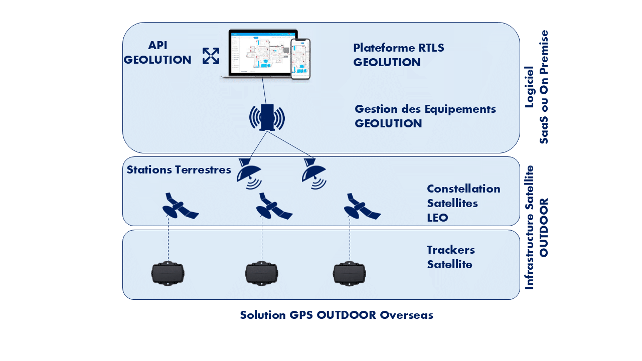
Our OUTDOOR Overseas geolocation solutions leverage GPS technology to provide precise location tracking, complemented by various satellite network technologies for data collection and transmission. These solutions are specifically designed for remote or maritime environments where terrestrial communication infrastructure is limited. Two operating models cater to the specific needs of use cases and connectivity constraints.
Direct communication with an LEO satellite constellation
In this model, the infrastructure relies on a constellation of Low Earth Orbit (LEO) satellites, providing extensive coverage and reliable connectivity. The entities to be geolocated are equipped with trackers featuring a modem and an antenna specially designed for direct communication with the satellites. The trackers use the communication protocol specific to the constellation, and transmissions depend on the satellite revisit times, enabling regular connectivity in remote or hard-to-reach areas.
Terrestrial network with satellite relay
In this second model, the data collection infrastructure relies on a private terrestrial network (LoRaWAN or cellular), which is then connected to the LEO satellite constellation. This method enhances coverage for sites equipped with a terrestrial network while leveraging satellite connectivity for long-distance transmissions, ensuring continuous and robust communication.
Integration of additional sensors via Bluetooth (BLE)
Trackers can also act as gateways for other Bluetooth Low Energy (BLE) sensors. This integration enables the collection of additional data, such as temperature, motion, or humidity, enriching the use case. This complementary information is gathered by the tracker and transmitted, allowing for comprehensive and optimized asset monitoring, whether in transit, at sea, or in remote locations.

GPS Technology
The solution uses GPS to determine object locations and satellite networks to transmit this data to a central database. This is particularly useful in areas with no cell coverage or internet connectivity.
LEO Satellites
In this model, objects or equipment to be tracked (e.g., ships or mobile equipment) are equipped with a tracker featuring a specialized antenna. This tracker connects directly to Low Earth Orbit (LEO) satellites, which regularly pass over the Earth, allowing the tracker to transmit location data whenever a satellite is in range.
Terrestrial network with satellite connection
In this model, the objects to be tracked first connect to a private terrestrial network (such as LoRaWAN or cellular), which is then linked to satellites to send the data to a central base. This approach allows for continuous tracking in locations where a local network is available but still requires satellites for long-distance transmissions.
Additional Sensors
In addition to geolocation, other sensors can be linked to the tracker via Bluetooth to collect extra information, such as temperature or object movement. The tracker acts as a gateway, enabling these sensors to transmit their data via satellite.
Contact Us
We are here to answer all your questions.
By Email
Via Form

